


Offline Map Navigation
4.31.79K Reviews
App Specs
- Version
- Varies with Device
- Updated On
- License
- Free
- Downloads
- 10,000,000+
- Developer
- VirtualMaze
- Categories
- Maps & Navigation
- Platform
- Android, iOS
Screenshots
 Analysis by AppCompare
I tend to notice how much I rely on mobile data only when it disappears: a road closure sends me off route, I enter a tunnel, or a long drive takes me beyond dependable coverage. Offline Map Navigation is built for that moment. It is a free navigation app from VirtualMaze, and its main appeal is having maps ready on the phone instead of depending entirely on a live connection. I see it as a practical backup as much as a travel tool, especially for drivers who already know that coverage can be unpredictable.
Getting Started with Offline Map Navigation
First things first, downloading and setting up the app was a breeze. It’s available for both Android and iOS, so no one’s left out. Once installed, I was greeted with a clean and intuitive interface, which was a pleasant surprise. You know how some apps are just a mess to navigate? Not this one. The controls and options were easy to find and use.
To start using the app, I had to download maps for the areas I planned to visit. Now, I was initially worried about how much space these maps would take up on my phone. But, turns out, the app does a great job at compressing them. I downloaded the entire state of California, and it didn’t hog my storage space.
Planning Offline Before You Leave
That download step is the part I would treat as essential rather than optional. Offline navigation only helps if the map for the place you are entering is already on your device. I would check the destination and the roads around it before leaving, rather than wait until the signal has dropped and assume the app can fetch what is missing. For a trip that crosses several regions, I would also leave time to confirm that each needed area is covered by the maps I saved.
There is a useful trade-off here: downloading in advance makes the app more dependable on the road, but it means thinking about storage and preparation. If I am heading somewhere unfamiliar, I would avoid deleting an area simply because I have reached the destination; the return route may pass through the same no-service stretch. This habit matters more than any clever navigation setting: an offline map is only useful when the right map is actually available.
Features That Stand Out
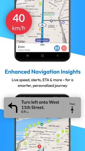
One of the coolest features I found was the voice-guided navigation. It’s not just there to look pretty; it actually works well. I was driving through unfamiliar streets, and the app guided me smoothly, alerting me well in advance before every turn. It even recalculates routes pretty swiftly if you decide to take a detour.
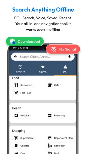
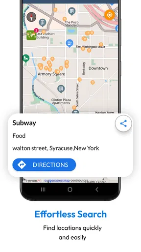
Another neat thing is the point of interest (POI) database. Whether you're looking for a gas station, a restaurant, or a tourist attraction, Offline Map Navigation has got you covered. I tested this feature by searching for a nearby coffee shop, and it popped up with several options, complete with ratings and reviews.
Worth Reading Before You Choose

EA SPORTS FC Mobile 26 Is a Bigger Football Game, but It Takes Time

Flipboard Shows What News Apps Must Do Beyond the Feed

Switching to Android Auto Means Rethinking Your Driving Routine

Google Calendar Makes a Crowded Week Easier to Manage

Ludo King Makes the Most of the Minutes Between Plans

Baby Panda World Brings Quick Play to Modern Phones, but Its Game Library Feels Busy
POI search is most helpful when I use it as a planning aid rather than a promise that every local business detail will be current. If I am choosing a stop on a route, I would check that the result is actually convenient for the direction I am travelling and keep a second option in mind. This is particularly useful on a longer drive: a nearby place on the map may not be the most practical stop if reaching it means doubling back or leaving the main road.
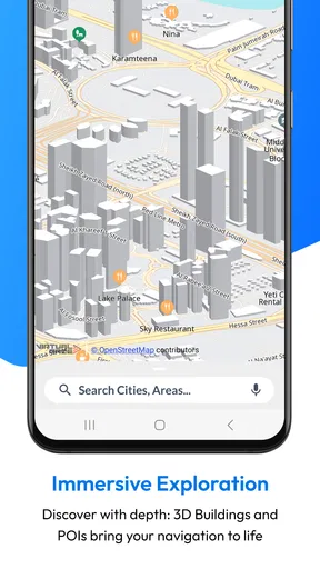
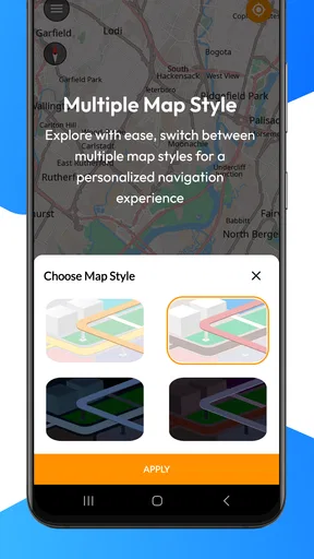
For those who are a bit geeky about mapping, the app also offers multiple map styles, like satellite or terrain view, which I found quite handy when exploring hiking trails. And yes, it’s all available offline!
Different views can answer different questions, but they do not replace good preparation. I find a road-focused view easier to scan while driving, while terrain or satellite imagery can be more useful before setting off to understand the shape of an area. For a hike, I would use those views to orient myself, not treat a navigation app as a substitute for route planning, local safety information, or a suitable trail map. That distinction keeps the app useful without asking it to do a job it was not designed to do.
Road Features and Driver Convenience
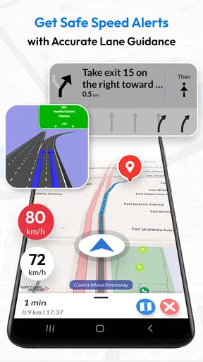
The app’s stated feature set also includes Android Auto, lane assistance and junction views, which make it more interesting for people who prefer guidance through a car display or need extra help interpreting complex road layouts. These are features I would weigh according to the trips I actually make: junction guidance can matter more in dense unfamiliar streets than on a familiar highway, while a driver who rarely uses Android Auto may get little added value from that option.
Before relying on any in-car navigation, I would set up the route and check the display while parked. That simple step helps me understand where instructions appear and avoids fumbling with a phone once the car is moving. The same principle applies to voice guidance: choosing a comfortable volume before departure is better than adjusting it at a busy intersection. Navigation features are most useful when they reduce distraction, not when they invite extra screen-tapping.
Real-World Usage
Now, let’s talk about how it performed in the real world. I took it on a weekend trip to the mountains, and there were stretches where cell service was non-existent. The app didn’t even flinch. I was able to navigate through winding mountain roads without a hitch.
One thing I noticed was that the GPS was spot-on. Even in areas with dense tree cover, the app managed to keep track of my location accurately. There was a moment when I thought I’d taken a wrong turn, but the app quickly rerouted me, and I was back on track.
Everyday Situations Where Offline Guidance Helps
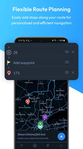
The mountain drive is an obvious case, but I also see a role for the app on ordinary journeys with an uncertain signal. Imagine driving to a relative’s home in a rural area after work: a diversion appears, mobile data becomes unreliable, and you still need to reach a particular road without stopping to hunt for service. Having the map already saved gives you a useful fallback. I would enter the destination before leaving, check the route while I still have a connection, and then let the phone guide me through the weaker-coverage stretch.
It can also be reassuring on international travel, long-distance road trips, or days when a mobile plan is limited, provided the necessary maps are downloaded beforehand. I would not assume that every online convenience works identically offline; the core reason to choose this app is access to saved mapping and navigation when connectivity is poor. For a traveller, that makes it a sensible second layer alongside local signs and a rough understanding of the route.
How It Fits Beside Familiar Navigation Apps
Compared with the usual online-first navigation apps, the clearest difference is the emphasis on having map coverage stored in advance. A mainstream app that is already set up with downloaded areas may suit someone who mostly drives in cities and wants a familiar everyday option. This app makes more sense to me when losing the connection is a realistic part of the journey, or when I want a dedicated offline fallback instead of relying on mobile data throughout.
That does not make it automatically better for every trip. Online services can be more convenient when live information is central to the decision, such as checking changing traffic conditions or exploring places spontaneously. I would choose based on the journey: use an online-first option when current conditions and quick discovery matter most, and consider Offline Map Navigation when the ability to keep navigating without a live connection is the priority. Keeping both approaches available is reasonable for a driver who travels in mixed conditions.
Cost, Rating, and What to Expect
The app is free to install, with in-app purchases listed from $0.99 to $29.99 per item. That gives a new user a way to try the basic experience before deciding whether any optional purchase is worthwhile. I would not spend money simply because an upgrade is offered; first, I would use the app on a familiar route and make sure its offline workflow suits me. The value depends on how often I need that capability and what the individual purchase provides to my own use.
Its 4.3 average from around 95,000 ratings suggests that many people have tried it, while the roughly 1,800 written reviews offer a smaller set of detailed opinions to explore. It has passed 5 million installs, and it is rated for Everyone. Those figures are useful context, not a guarantee that it will fit every phone, route, or driving habit. VirtualMaze is the developer, and I would judge the app by testing the specific map area and guidance features I expect to rely on.
One practical question is whether I should pay before trying it. My answer is no: because the app is free to start, I would first test a short route with a saved map and decide whether the offline experience is valuable to me. Another is whether it is only for people who travel far from cities. I do not think so; an urban driver can still benefit from prepared maps during a weak-signal trip, although someone who always has dependable service may find less reason to add another navigation app.
Where the Trade-Offs Matter
Offline capability does not remove the need to plan. The user has to choose and download the relevant coverage in advance, and forgotten areas can undermine the main reason for installing the app. Downloaded maps also use device storage, so I would keep only the regions I am likely to need and revisit that choice after a trip. If I am regularly travelling through new places, I would build map preparation into the same routine as checking the car and packing.
There is also a difference between having a route and having the freshest possible picture of the road. For a complicated city trip or a journey where changing traffic is the deciding factor, I would favour a service whose online information is central to the experience. Offline Map Navigation is a more compelling choice when dependable access to a saved map matters more than the convenience of staying connected to every live service. That is a real distinction, not a flaw that can be solved by tapping through more settings.
I would also keep safe driving habits in view. Set up navigation before moving, use voice directions where practical, and pull over if a route decision needs attention. A junction view or lane assistance can help make instructions easier to interpret, but neither should replace watching signs and traffic. On a mountain road in particular, I would rather miss a turn safely and let the app recalculate than handle the phone while driving.
Who Gets the Most Value
I would recommend trying it if you often take road trips, travel through rural or mountainous areas, visit places with patchy coverage, or want a backup in case mobile data drops. It is also a reasonable fit for people who prefer preparing a route in advance and value offline access more than spontaneous, connection-dependent discovery. Android Auto support, lane assistance and junction views may add appeal for drivers who make use of those tools.
I would skip it, or at least avoid making it my only navigation choice, if I rely heavily on current online traffic information, frequently change destinations at the last minute, or do not want to manage downloaded maps. Hikers looking for a dedicated outdoor navigation solution should also assess their specific needs rather than assume that terrain and satellite views make a road-navigation app a complete trail tool. The right choice depends on whether offline road guidance solves a problem I actually encounter.
Final Thoughts on Offline Map Navigation
Overall, I have to say, Offline Map Navigation exceeded my expectations. It’s a solid app for anyone who needs reliable navigation without depending on an internet connection. From its easy setup to its robust features, it’s clear that a lot of thought went into making this app user-friendly.
If you’re someone who loves to travel, frequently goes off the grid, or just wants a backup navigation tool, give this app a shot. You’ll have peace of mind knowing you’re covered, even when the internet isn't. Just remember to download your maps before hitting the road!
My final recommendation is to begin with one route you know well, save the map for a place where coverage can be uncertain, and try the guidance before you need it in earnest. That small test answers the most useful questions: whether the controls make sense to you, whether the downloaded area is sufficient, and whether the app earns a place beside your usual navigator. If that offline safety net is valuable, the free starting point makes trying it an easy decision; if live traffic and spontaneous planning matter more, your familiar online option may remain the better everyday choice.
Pros
- No internet connection needed.
- Detailed maps with landmarks.
- User-friendly interface.
- Regular updates for accuracy.
- Customizable map styles.
Cons
- Limited real-time traffic info.
- Large app size for storage.
- Frequent ads in free version.
- Some areas lack detail.
- Slow initial load times.
FAQs for Offline Map Navigation
Is Offline Map Navigation truly usable without an internet connection?
Yes, Offline Map Navigation is fully functional without an internet connection. You need to download the maps of the areas you'll be visiting beforehand. Once downloaded, the app provides turn-by-turn navigation, real-time distance calculations, and points of interest without needing any data connectivity.
How accurate is the GPS tracking in Offline Map Navigation?
The GPS tracking in Offline Map Navigation is highly accurate, leveraging your device's built-in GPS. It offers precise location tracking and follows your route accurately. However, it's important to note that GPS accuracy can be affected by environmental factors such as tall buildings or dense forests.
What regions or countries are supported by Offline Map Navigation?
Offline Map Navigation covers a wide range of regions and countries globally. Before downloading, you can check the app's map library to confirm coverage of your desired locations. It includes most major cities and popular travel destinations, ensuring comprehensive support for travelers.
Are there additional costs associated with using Offline Map Navigation?
Offline Map Navigation is typically free to download, but some features may require in-app purchases. For instance, premium features like voice-guided navigation or additional map details may incur extra costs. Always check the app's pricing model to understand any potential expenses.
How frequently are the maps updated in Offline Map Navigation?
Maps in Offline Map Navigation are regularly updated to ensure accuracy and reflect any changes in road networks or points of interest. Users are notified when updates are available, and it's recommended to download these updates to maintain the most current navigation information.


